Common Ground / A digital literacy workshop

AI Bias Awareness.

How artificial intelligence can reproduce bias, and how to examine images critically.

What is AI Bias?

Artificial intelligence learns from data created by humans — and humans have biases. When AI systems are trained on datasets that overrepresent certain groups or underrepresent others, the technology reproduces and amplifies those imbalances.

This means AI can generate images that lighten skin tones, alter natural hair textures, narrow facial features, or default to Western beauty standards — even when no one explicitly programmed it to do so.

Bias in Images: See It for Yourself

AI image tools don't just generate — they alter. When asked to "enhance" or "improve" a photo, AI systems frequently change the subject's appearance in ways that reflect deep biases in their training data. Here are real patterns researchers have documented:

Skin Tone Lightening

Darker color sample
Illustrative color sample
Conceptual example
Lighter color sample
Illustration only; not a measured AI result

Studies show AI image generators consistently lighten skin tones, especially for darker-skinned individuals. This happens because training datasets overrepresent lighter-skinned faces, teaching the AI that "better" means "lighter."

Hair Texture Alteration

Natural curls & coils
Authentic texture
4C coils, locs, braids, natural styles
Straightened by AI
AI "corrected"
Curls smoothed, texture removed

AI tools frequently straighten curly and coiled hair textures when "enhancing" photos. Natural Black hairstyles — locs, braids, afros, twists — are treated as imperfections to fix rather than expressions of identity and culture.

Facial Feature Narrowing

Broad nose
Natural feature
Full lips
Natural feature
AI "refined"
Narrowed & thinned

AI tools often narrow noses, thin lips, and slim jawlines — reshaping faces toward a single Eurocentric template. Features common across African, Asian, Indigenous, and Latinx communities are systematically minimized.

No one should be changed. Images should be authentic and no part of the person should be erased.

How AI Defaults to Western Beauty Standards

AI doesn't have opinions about beauty — but the data it learns from does. The vast majority of images used to train AI systems come from Western media, fashion, and advertising, which have historically promoted a narrow set of features as "ideal."

Conceptual diagram · not measured results
  1. Training data
  2. AI output
  3. Public perception
  4. New data

Follow how an imbalance can return to the beginning.

1
Training data imbalance

Datasets used to train image AI are overwhelmingly sourced from Western media. Faces and bodies that appear most frequently become the AI's definition of "normal" — everything else becomes a deviation to "correct."

2
The "enhancement" trap

When users ask AI to "enhance" or "beautify" a photo, the system applies learned biases: lighter skin, straighter hair, thinner features, smoother texture. The word "enhance" becomes a euphemism for erasure.

3
Homogenization of beauty

AI tools push every face toward the same template — small nose, light skin, straight hair, angular jaw. This erases the stunning diversity of human appearance and tells people from non-Western cultures that their natural features are flaws.

4
Feedback loops

When AI-altered images flood social media, they reshape public perception of "normal" appearance. People begin to feel their unaltered faces don't measure up — not to reality, but to an AI-manufactured ideal.

The research record

34.7%

error rate for facial-analysis systems on darker-skinned women — vs 0.8% for lighter-skinned men.

Buolamwini & Gebru, Gender Shades (MIT / Microsoft, 2018)

45%+

of images in popular training datasets depict subjects from the U.S. and Western Europe.

Shankar et al., No Classification Without Representation (NeurIPS, 2017)

Systemic

image-generation models reproduce and amplify occupational and racial stereotypes from training data.

Bianchi et al., Stanford HAI (2023)

Research sources: Buolamwini & Gebru (Proceedings of Machine Learning Research, 2018); Shankar et al. (NeurIPS Workshop on Machine Learning for the Developing World, 2017); Bianchi, Kalluri, Durmus et al. (Stanford Human-Centered AI Institute, 2023). Findings quoted above are approximate and directional; consult original papers for methodology.

Cultural Erasure

When AI alters someone's appearance, it doesn't just change pixels — it can erase cultural identity. Natural hair textures, skin tones, facial features, and traditional adornments are not "imperfections" to be corrected. They are expressions of heritage, identity, and belonging.

AI systems that default to Eurocentric standards of appearance perpetuate the harmful message that some identities need to be "fixed" — a message directly contrary to everything Pomfret's DEI mission stands for.

This website’s approach

1
Transparent Labeling
AI-generated material must be clearly labeled. The diagrams on this page are illustrative examples.
2
Authentic Photography
Our photo policy prohibits AI enhancement and changes to skin tone, hair texture, facial features, or apparent age.
3
Content Review
Source attribution and photo consent require editorial review before publication.
4
Education
This module exists to make our community aware of AI bias, not just on our platform, but everywhere they encounter AI.
5
Honest Acknowledgment
We know AI tools are imperfect. Instead of hiding from that reality, we confront it openly.

Test Your Knowledge

Question 1 of 3

An AI generates a portrait of a historical figure. The skin tone appears lighter than historical photographs. Is this an example of AI bias?

Part two · What this site made with AI

The Film Register

Every moving picture on this site that an AI model helped make has a row here: what it started from, what the model invented, which takes we threw away and why, and what it cost. The two renders of the real 2023 survey are listed too, because they are not AI and should never be mistaken for it.

  • 07 AI plates registered
  • 05 on the site
  • 02 held, shown nowhere
  • 07 takes rejected
  • 02 survey renders, not AI
  • 144.5 generation credits spent

One photograph, one plate.

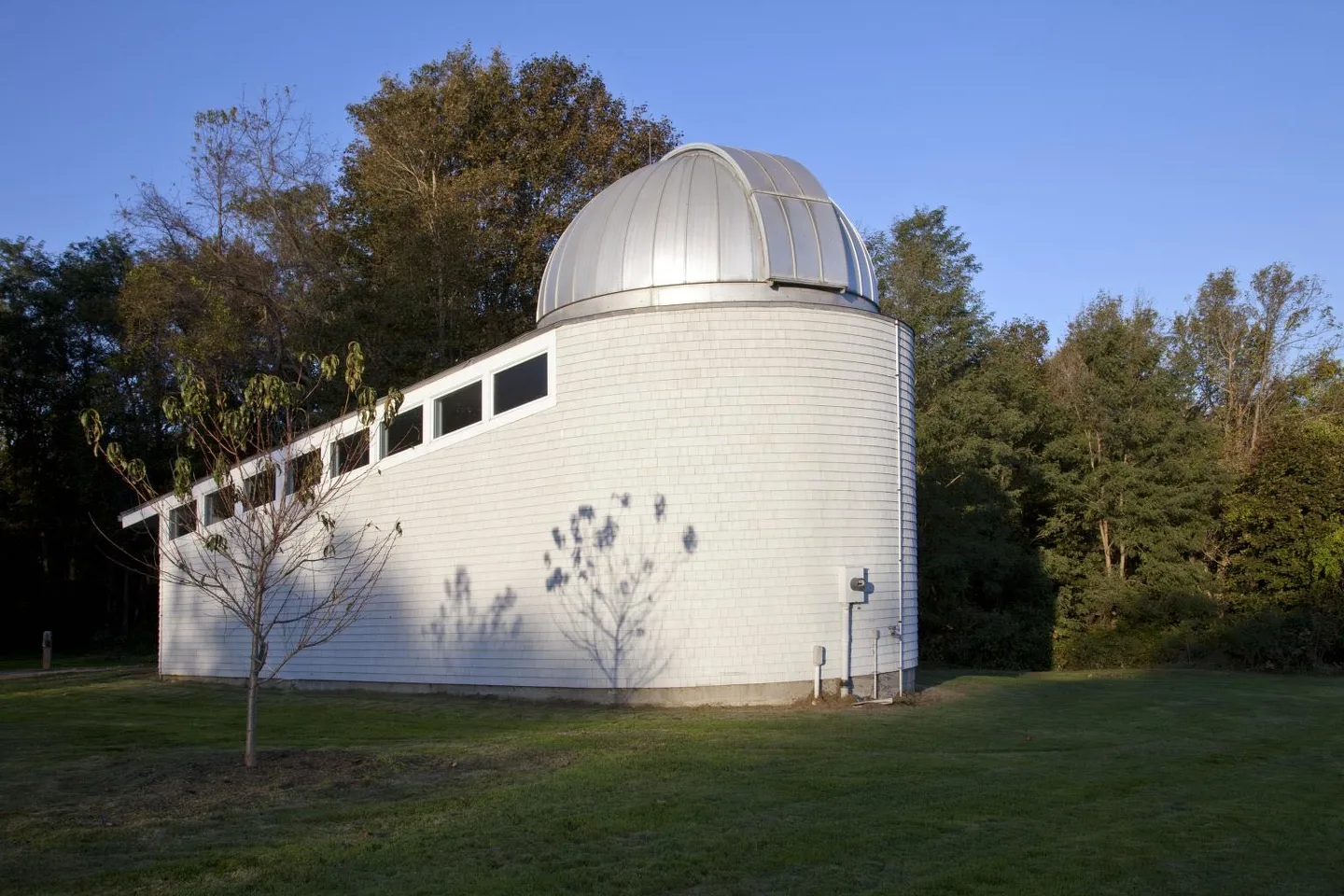
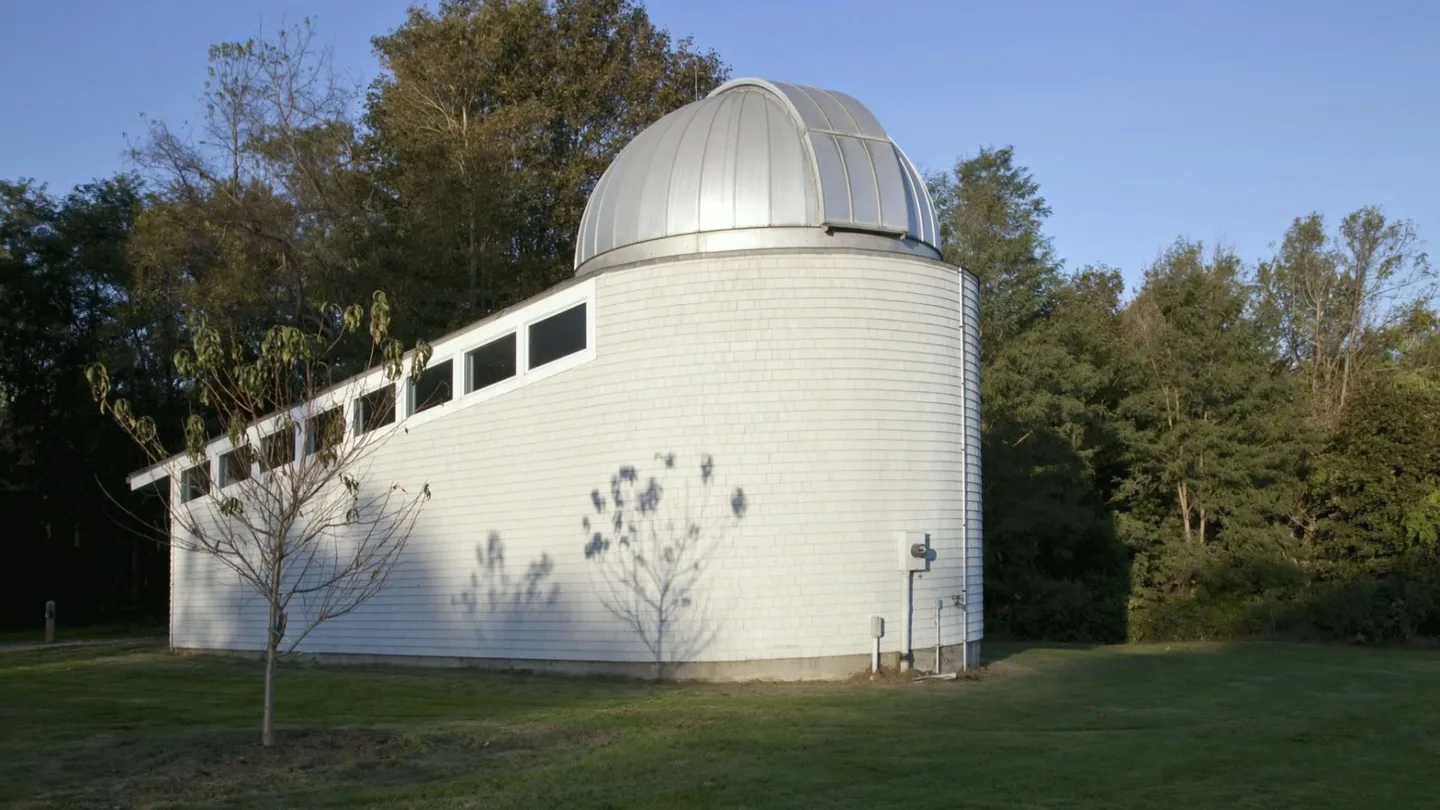
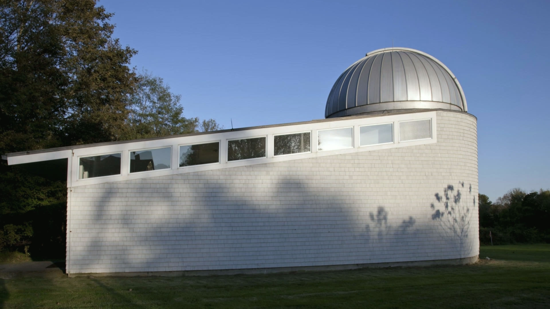
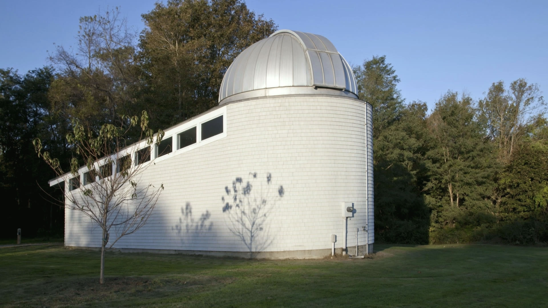
Under the seam, Carol M. Highsmith’s 2011 photograph of the observatory, whole and unaltered. Over it, the first frame of the plate a model grew from that photograph, in the exact 16:9 crop it started from. Drag the seam. They look almost the same, and that is the point: from this frame on, everything the camera reveals is invented.

Color photograph of the white-shingled Alumni House Observatory with its silver dome, on a mowed lawn against trees and a clear blue sky. No people visible.
This is a photograph.Carol M. Highsmith — Library of Congress, Carol M. Highsmith Archive, October 2011. Unaltered, at its own 3:2 ratio: drag the seam fully right to see it whole.Public domain (Carol M. Highsmith Archive, Library of Congress) · Library of Congress record
AI-generated atmosphere: the white shingled observatory on its lawn, animated from a 2011 public-domain photograph.
This is not.AI-generated atmosphere · not a photographAI-animated from a public-domain photograph: the first frame of observatory-rise.Then invented: the camera rise; everything outside the original photograph’s frame that the rise reveals; leaf and cloud movement.

How we kept people out

  1. We started from buildings and ground. Every plate begins from a public-domain photograph of a building or from a render of the 2023 aerial survey, where a person would be a few pixels and could not be identified. The chapel photograph was cropped to its apse so that a person in the full picture was left out.
  2. We asked for no one. Every prompt asks for no people and no text, and the hill plates ask for no moving vehicles either. The prompts are summarised in each row below.
  3. We checked every frame. Every take checked as frame strips plus full-resolution stills at start, middle and end, and per-frame difference statistics for flicker or jumps. Any take with a person or a figure, text, a warped or invented building, or flicker is rejected; 7 takes were set aside in all.
  4. We cut a shot when something came into it. Rise off the hill ends at 4.6 s because a bird enters the frame after 4.6 s.
  5. We stopped when the model drew people anyway. The Clark Chapel apse plate had no person in its crop, but the model re-drew the human figures in the memorial windows on every frame. It is held off every page, and not deployed, until the project owner decides. Its row below shows no media.
  6. Real photographs of people never go near a model. No portrait, yearbook page or archive scan on this site has been enhanced, regenerated or altered by AI, and none was used as a start frame.

Why we film the hill and never the people

The modules above show what image models do to faces by default: they lighten skin, straighten hair and narrow features. A generated image can be beautiful and still be wrong. So the only things this site lets a model touch are weather, light and a camera moving over buildings and fields whose layout comes from a real survey or a public-domain photograph. The people in this archive appear only in their own photographs: whole, unaltered and credited.

The register

The register at a glance: 9 entries, one per plate or survey render.
No.EntryKindAppears onMade withLengthCredits
01hill-octoberAI over surveyHomeKling 3.05.0 s9.00
02hill-october-longAI over surveyHeld — owner decision pendingKling 3.010.0 s17.50
03hill-blue-hourAI over surveyHome, Page not found (404), /archiveKling 3.05.0 s9.00
04hill-fogAI over surveyHome, /sources, AccessibilityKling 3.05.0 s9.00
05observatory-pushAI from photographCampus tour, Tour · Olmsted ObservatoryKling 3.05.0 s8.75
06observatory-riseAI from photographHome, Tour · Olmsted Observatory, AI & Bias (this page)Kling 3.04.6 s8.75
07chapel-apseAI from photographHeld — owner decision pendingKling 3.05.0 s8.75
08hero-scanReal survey · not AIHome, /sourcesFrame sequence—0.00
09survey-explorerReal survey · not AICampus tour, Tour · Clark Memorial Chapel, Tour · School House, Tour · Centennial Garden, Tour · Jahn Rink, Tour · Olmsted Observatory, Tour · Hard AuditoriumWebGL point cloud—0.00
  1. hill-october · AI over the real 2023 survey

    The Hill in October

    On the site · Home
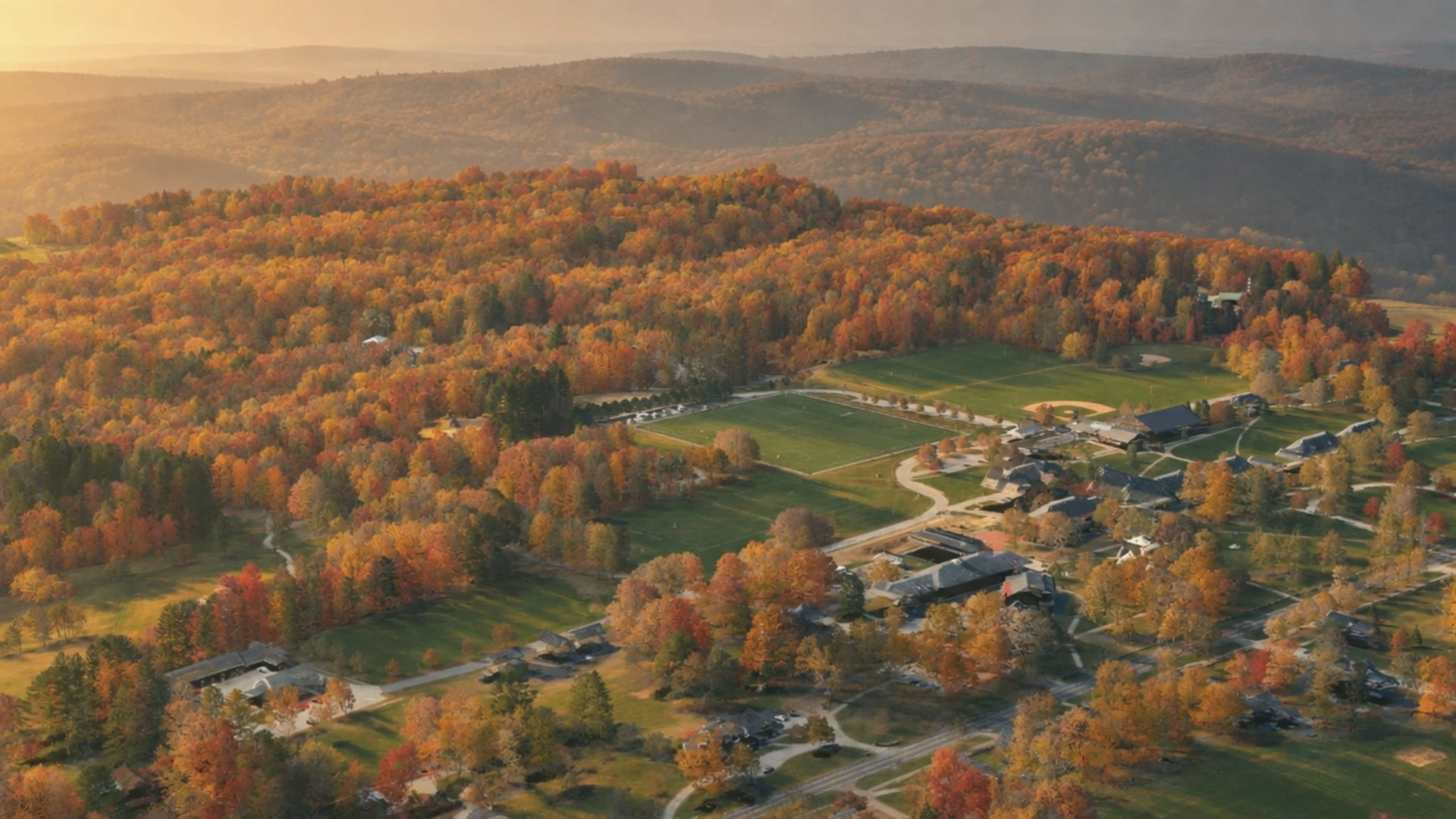
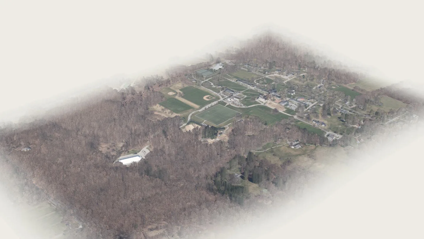
    hill-octoberAI-generated atmosphere over a real 2023 survey of the campusCT State GIS Office. (2023). 2023 Aerial imagery. Retrieved from https://maps.cteco.uconn.edu/data/flight2023/. Lidar: 2023 Connecticut Statewide Lidar, NOAA Office for Coastal Management Digital Coast, dataset 10296.
    Where it appears
    Home
    Model
    Higgsfield · Kling 3.0
    Variant
    kling3_0 pro, image-to-video, start image only, sound off
    Duration
    5.04 s · 16:9 · plays once and holds its last frame
    Started from
    A render of the real 2023 LiDAR survey of the whole campus from the south-east, regraded to an October golden hour with GPT Image 2.5 (layout kept fixed). Source. Real public survey data (2023 CT LiDAR, NOAA Digital Coast 10296; CT ECO 2023 orthophoto, use limitations none). The regraded start image is AI.
    What we asked for
    Slow, level drone glide forward and slightly down toward the playing fields and the building line; every building, road, field and tree keeps its place; golden-hour October light; no people, no moving vehicles, no text.
    Generated
    October 7, 2026 · job 1113cef3-0fbf-40ce-9d99-f9c2bae5fe98 · start image dff6b202-d762-40ad-a9cf-e9d33f8a05cd
    Credits
    9.00 (kept take and its start image)
    Reviewed
    October 7, 2026, frame by frame · kept

    What is invented

    • sky and the distant hills beyond the edge of the scan
    • the season: the survey was flown in April with bare trees; the autumn foliage colour is invented
    • the light, shadows and haze (time of day)
    • building walls and facade detail the aerial survey cannot see (it records roofs)
    • all motion, including the camera move

    Takes rejected, and why

    • 7bf0aa94-da3a-4fb9-9fce-d468997e5d08 · kling3_0 pro 5 s · 8.75 credits. Glide from the un-regraded scan render (early-spring look). Not selected in the 2026-10-07 review; the October regrade was kept instead.

    Review notes

    • Plays once and holds its last frame (44 px replay). Not looped: a loop dissolve on this moving-camera shot double-imaged the buildings (wave-1 re-review, 2026-10-07); re-encoded as a straight trim of the whole take.

    Higgsfield · Kling 3.0 · Oct 2026 · animated from a render of the 2023 Connecticut LiDAR and CT ECO aerial survey, regraded to autumn. The layout is real; the season, light, sky and distant hills are invented.
  2. hill-october-long · AI over the real 2023 survey

    The Hill in October (10 s)

    Held — owner decision pending

    Held — owner decision pendingNo media is shown for a held plate, and its files are not placed on any page.

    Why it is held. Not used on the homepage: with the hero scan frames it breaks the 8 MB per-route video budget (HOME_HERO_PLATE). Kept registered for a later route that has room for a 10 s take.

    Where it appears
    Nowhere on the site
    Model
    Higgsfield · Kling 3.0
    Variant
    kling3_0 pro, image-to-video, start image only, sound off
    Duration
    10.04 s · 16:9 · plays once and holds its last frame
    Started from
    The same regraded LiDAR render as hill-october (its first frame matches the last frame of the real-data hero scan). Source. Real public survey data (2023 CT LiDAR, NOAA Digital Coast 10296; CT ECO 2023 orthophoto, use limitations none). The regraded start image is AI.
    What we asked for
    One slow steady forward glide with a very gentle descent, level horizon; layout fixed; warm low sun, haze over distant hills; no people, no moving vehicles, no birds, no text.
    Generated
    October 7, 2026 · job 7e1f68eb-5314-4054-85c8-1d5c001559fe · start image dff6b202-d762-40ad-a9cf-e9d33f8a05cd
    Credits
    17.50 (kept take and its start image)
    Reviewed
    October 7, 2026, frame by frame · kept

    What is invented

    • sky and the distant hills beyond the edge of the scan
    • the season: the survey was flown in April with bare trees; the autumn foliage colour is invented
    • the light, shadows and haze (time of day)
    • building walls and facade detail the aerial survey cannot see (it records roofs)
    • all motion, including the camera move

    Takes rejected, and why

    None: the first take was kept.

    Higgsfield · Kling 3.0 · Oct 2026 · animated from a render of the 2023 Connecticut LiDAR and CT ECO aerial survey, regraded to autumn. The layout is real; the season, light, sky and distant hills are invented.
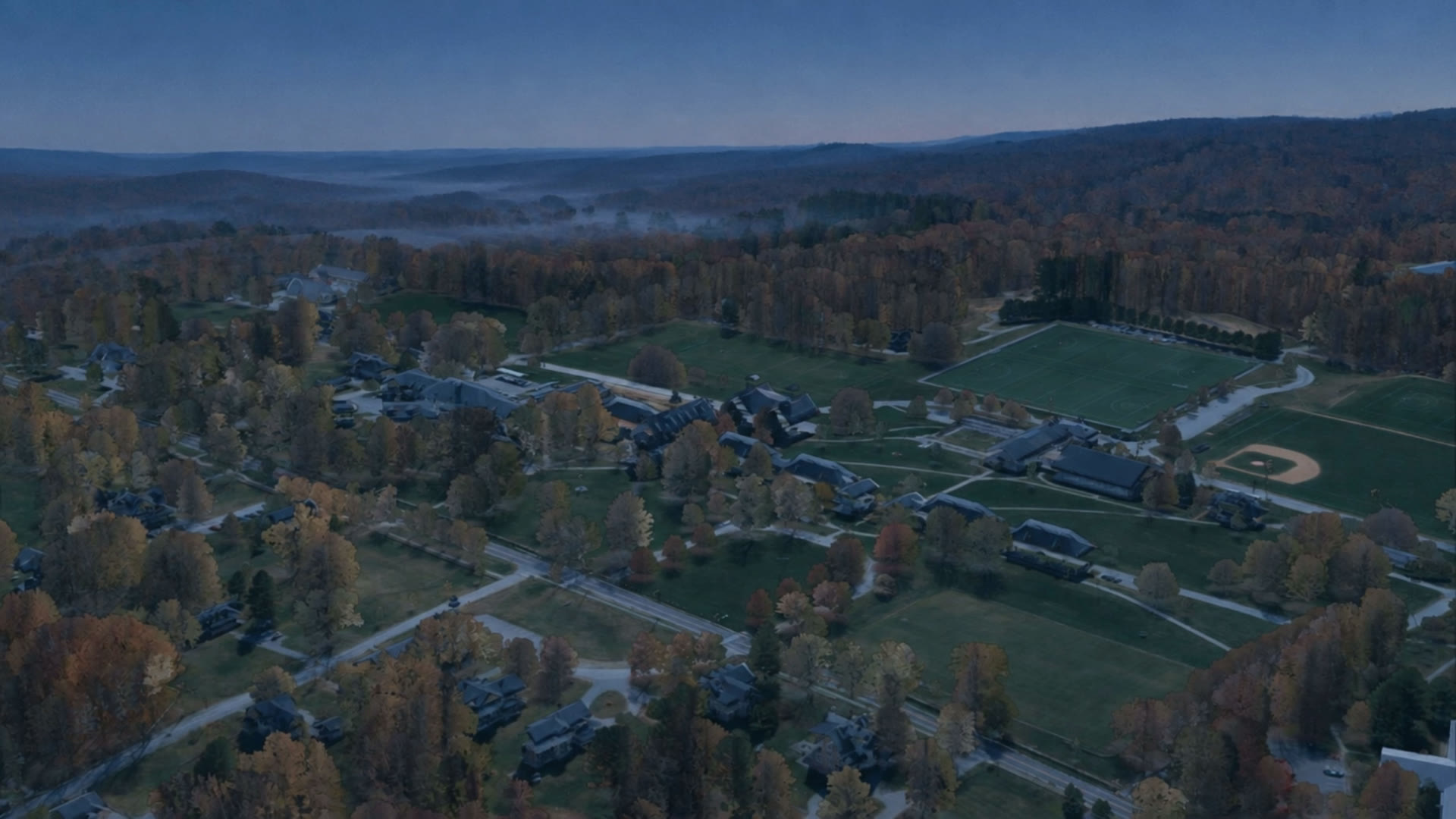
  3. hill-blue-hour · AI over the real 2023 survey

    The Hill at blue hour

    On the site · Home, Page not found (404), /archive

    hill-blue-hourAI-generated atmosphere over a real 2023 survey of the campusCT State GIS Office. (2023). 2023 Aerial imagery. Retrieved from https://maps.cteco.uconn.edu/data/flight2023/. Lidar: 2023 Connecticut Statewide Lidar, NOAA Office for Coastal Management Digital Coast, dataset 10296.
    Where it appears
    Home, Page not found (404), /archive
    Model
    Higgsfield · Kling 3.0
    Variant
    kling3_0 pro, image-to-video, start image only, sound off
    Duration
    5.04 s · 16:9 · plays once and holds its last frame
    Started from
    A new render of the real 2023 LiDAR survey from the north-east over the dormitory row and the fields, regraded to an October blue hour with GPT Image 2.5 (layout kept fixed; windows dark). Source. Real public survey data (2023 CT LiDAR, NOAA Digital Coast 10296; CT ECO 2023 orthophoto, use limitations none). The regraded start image is AI.
    What we asked for
    Very slow forward drift, level; the sky deepens to a darker blue and low mist drifts; windows stay dark, no lights, no stars; no people, no moving vehicles, no text. A preset suggestion ("In the Dark") was declined and the prompt run literally.
    Generated
    October 7, 2026 · job b62923b6-2c97-4462-9745-c2914d61b973 · start image 11fa4e25-3e54-4ad2-9bbc-62084081151e
    Credits
    9.00 (kept take and its start image)
    Reviewed
    October 7, 2026, frame by frame · kept

    What is invented

    • sky and the distant hills beyond the edge of the scan
    • the season: the survey was flown in April with bare trees; the autumn foliage colour is invented
    • the light, shadows and haze (time of day)
    • building walls and facade detail the aerial survey cannot see (it records roofs)
    • all motion, including the camera move
    • the low mist in the valleys

    Takes rejected, and why

    None: the first take was kept.

    Review notes

    • Plays once and holds its last frame (44 px replay). Not looped: a loop dissolve on this moving-camera shot double-imaged the buildings (wave-1 re-review, 2026-10-07); re-encoded as a straight trim of the whole take.

    Higgsfield · Kling 3.0 · Oct 2026 · animated from a render of the 2023 Connecticut LiDAR and CT ECO aerial survey, regraded to blue hour. The layout is real; the season, light, sky, mist and distant hills are invented.

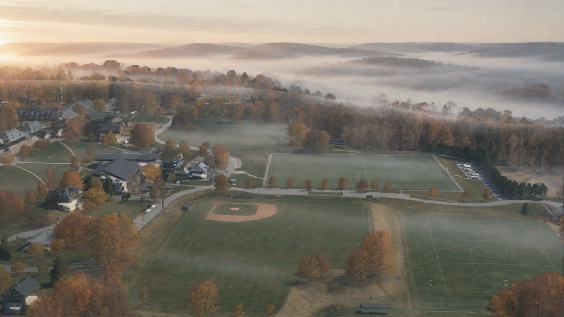
  4. hill-fog · AI over the real 2023 survey

    Fog lifting off the fields

    On the site · Home, /sources, Accessibility

    hill-fogAI-generated atmosphere over a real 2023 survey of the campusCT State GIS Office. (2023). 2023 Aerial imagery. Retrieved from https://maps.cteco.uconn.edu/data/flight2023/. Lidar: 2023 Connecticut Statewide Lidar, NOAA Office for Coastal Management Digital Coast, dataset 10296.
    Where it appears
    Home, /sources, Accessibility
    Model
    Higgsfield · Kling 3.0
    Variant
    kling3_0 pro, image-to-video, start image only, sound off
    Duration
    5.04 s · 16:9 · plays once and holds its last frame
    Started from
    A new render of the real 2023 LiDAR survey from the north, across the athletic fields toward the campus, regraded to an early October morning with ground fog by GPT Image 2.5 (layout kept fixed). Source. Real public survey data (2023 CT LiDAR, NOAA Digital Coast 10296; CT ECO 2023 orthophoto, use limitations none). The regraded start image is AI.
    What we asked for
    Very slow forward drift, level; low fog thins and lifts off the fields and the valley; soft early sun on the treetops; no people, no moving vehicles, no text.
    Generated
    October 7, 2026 · job 1e4ad439-d73a-4bb4-94ad-cd73f8b2e724 · start image 3f0052d2-9ec9-42e8-967f-13c46c9cc0e0
    Credits
    9.00 (kept take and its start image)
    Reviewed
    October 7, 2026, frame by frame · kept

    What is invented

    • sky and the distant hills beyond the edge of the scan
    • the season: the survey was flown in April with bare trees; the autumn foliage colour is invented
    • the light, shadows and haze (time of day)
    • building walls and facade detail the aerial survey cannot see (it records roofs)
    • all motion, including the camera move
    • the fog and dew

    Takes rejected, and why

    None: the first take was kept.

    Review notes

    • Plays once and holds its last frame (44 px replay). Not looped: a loop dissolve on this moving-camera shot double-imaged the buildings (wave-1 re-review, 2026-10-07); re-encoded as a straight trim of the whole take.

    Higgsfield · Kling 3.0 · Oct 2026 · animated from a render of the 2023 Connecticut LiDAR and CT ECO aerial survey, regraded to a foggy morning. The layout is real; the season, light, fog, sky and distant hills are invented.
  5. observatory-push · AI from a public-domain photograph

    Push-in to the dome

    On the site · Campus tour, Tour · Olmsted Observatory

    observatory-pushAI-animated from a public-domain photograph
    Model
    Higgsfield · Kling 3.0
    Variant
    kling3_0 pro, image-to-video, start image only, sound off
    Duration
    5.04 s · 16:9 · plays once and holds its last frame
    Started from
    Carol M. Highsmith, “Pomfret School Alumni House Observatory, Pomfret, Connecticut”, October 2011, Library of Congress 2012631212, cropped to 16:9 without retouching. Source. Public domain (Carol M. Highsmith Archive, Library of Congress)
    What we asked for
    Very slow dolly forward about one metre, 50 mm, locked horizon; shingles, windows and dome keep their exact shape and count; leaves move in a light wind; no people, no text.
    Generated
    October 7, 2026 · job 22ad4c1a-1905-4c13-bd33-e64a092ffa9c
    Credits
    8.75 (kept take)
    Reviewed
    October 7, 2026, frame by frame · kept

    What is invented

    • the camera move and the parallax it reveals
    • leaf and light movement

    Takes rejected, and why

    • 662fb114-23a5-429e-b8dc-b44cf558b4fb · seedance_2_5 480p draft · 15.00 credits. Earlier observatory dolly draft; not selected in the 2026-10-07 review (reason not recorded).

    Higgsfield · Kling 3.0 · Oct 2026 · grown from LoC 2012631212 (Highsmith, 2011, public domain). The photograph itself is shown unaltered on the tour stop.

  6. observatory-rise · AI from a public-domain photograph

    Rise off the hill

    On the site · Home, Tour · Olmsted Observatory, AI & Bias (this page)

    observatory-riseAI-animated from a public-domain photograph
    Where it appears
    Home, Tour · Olmsted Observatory, AI & Bias (this page)
    Model
    Higgsfield · Kling 3.0
    Variant
    kling3_0 pro, image-to-video, start image only, sound off
    Duration
    4.58 s · 16:9 · plays once and holds its last frame
    Started from
    Carol M. Highsmith, “Pomfret School Alumni House Observatory, Pomfret, Connecticut”, October 2011, Library of Congress 2012631211, cropped to 16:9 without retouching. Source. Public domain (Carol M. Highsmith Archive, Library of Congress)
    What we asked for
    Very slow crane up and back, 24 mm, level; reveals more lawn and the surrounding oaks and maples; architecture rigid; no other buildings, no roads, no people, no text.
    Trimmed
    0–4.6 s. A bird enters the frame after 4.6 s.
    Generated
    October 7, 2026 · job bfcba978-fdc9-4746-ab35-2c4cec3b58d8
    Credits
    8.75 (kept take)
    Reviewed
    October 7, 2026, frame by frame · kept

    What is invented

    • the camera rise
    • everything outside the original photograph’s frame that the rise reveals
    • leaf and cloud movement

    Takes rejected, and why

    None: the first take was kept.

    Higgsfield · Kling 3.0 · Oct 2026 · grown from LoC 2012631211 (Highsmith, 2011, public domain). The camera rise and everything outside the original frame are invented.

  7. chapel-apse · AI from a public-domain photograph

    Clark Chapel apse

    Held — owner decision pending

    Held — owner decision pendingNo media is shown for a held plate, and its files are not placed on any page.

    Why it is held. Owner decision pending (ownerDecisionPending): the AI model redrew the memorial windows, which show human figures and inscriptions. Not placed on any route, and its files are excluded from deployment in .vercelignore, until the owner rules.

    The question for the owner (raised October 7, 2026). The three memorial windows in this plate show human figures (an angel, a saint, an adult with a child), inscription panels and a flag with a crest, all re-drawn by the AI model from a 2011 photograph. May an AI-redrawn depiction of figures and memorial inscriptions appear on the chapel stop, captioned as such, or should the plate be cut or re-cropped to the stone and timber only?

    Where it appears
    Nowhere on the site
    Model
    Higgsfield · Kling 3.0
    Variant
    kling3_0 pro, image-to-video, start image only, sound off
    Duration
    5.04 s · 16:9 · plays once and holds its last frame
    Started from
    Czelusniak et Dugal, “Clark Chapel Pomfret School Interior”, 2011, Wikimedia Commons, cropped to the apse so that a person visible in the full photograph is excluded. Source. Public domain (as stated on the Commons file page; owner to re-verify per spec 11.1)
    What we asked for
    Extremely slow dolly toward the apse, 35 mm, level; fieldstone arch, timber ceiling, three stained-glass windows, organ pipes and the flag keep their exact shape; late-afternoon light and faint dust; no people, no figures, no text.
    Generated
    October 7, 2026 · job e1015edc-e04d-4aed-8fd3-467b45a5c5a7
    Credits
    8.75 (kept take)
    Reviewed
    October 7, 2026, frame by frame · kept

    What is invented

    • the camera move and parallax
    • the light change and dust in the air
    • every detail of the three memorial windows as seen in motion: the human figures in the glass (an angel, a saint, an adult with a child), the inscription panels beneath them and the lead lines are re-drawn by the AI model on every frame, not copied from the photograph
    • the crest and folds of the flag as it is re-drawn in motion

    Takes rejected, and why

    • 5b68ec69-7517-44f9-a9ba-d5ac4b231af5 · kling3_0 pro 5 s, start = end image · 8.75 credits. Moving stained-glass light with the same start and end frame: start = end freezes the shot (Addendum A).

    Review notes

    • Camera move confirmed from frames 0, 60 and 119 (2026-10-07 review): a slow push-in toward the apse; the arch, windows and organ pipes grow in frame and the flag leaves the frame on the right.

    Higgsfield · Kling 3.0 · Oct 2026 · grown from a public-domain photograph of the Clark Chapel interior (Czelusniak et Dugal, 2011, Wikimedia Commons). The camera move and light are invented, and the figures and inscriptions in the windows are re-drawn by the AI.

  8. hero-scan · Real survey data · not AI

    Flight over the 2023 survey

    On the site · Home, /sources

    hero-scan2023 LiDAR + aerial survey · CT State GIS Office. Real survey data, rendered without AI.CT State GIS Office. (2023). 2023 Aerial imagery. Retrieved from https://maps.cteco.uconn.edu/data/flight2023/. Lidar: 2023 Connecticut Statewide Lidar, NOAA Office for Coastal Management Digital Coast, dataset 10296. © OpenStreetMap contributors (ODbL 1.0).
    Where it appears
    Home, /sources
    What it is
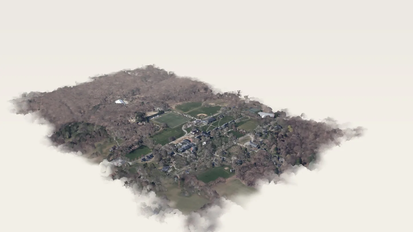
    A pre-rendered frame sequence. A 60-frame camera flight over the real 2023 LiDAR point cloud of the whole campus (71.9 million returns, coloured from the 3-inch 2023 orthophoto), rendered without AI: soft depth-sized point splats, eye-dome edge shading and distance haze. The quiet sky and the fade at the edge of the scanned area are rendering choices, not data. Its last frame shares the camera of the still behind hill-october (the raw take’s first frame, which is also the plate’s first frame). The survey pins over it are placed from OpenStreetMap building outlines.
    Made with
    scripts/lidar/hero_flight.py, scripts/lidar/export_hero.py
    AI
    None.
    Cited as
    • CT State GIS Office. (2023). 2023 Aerial imagery. Retrieved from https://maps.cteco.uconn.edu/data/flight2023/.
    • Lidar: 2023 Connecticut Statewide Lidar, NOAA Office for Coastal Management Digital Coast, dataset 10296.
    • © OpenStreetMap contributors (ODbL 1.0): building outlines that place the tour-stop pins.
  9. survey-explorer · Real survey data · not AI

    Explore the Hill in 3D

    On the site · Campus tour, Tour · Clark Memorial Chapel, Tour · School House, Tour · Centennial Garden, Tour · Jahn Rink, Tour · Olmsted Observatory, Tour · Hard Auditorium

    survey-explorer2023 LiDAR + aerial survey · CT State GIS Office. Real survey data, rendered without AI.CT State GIS Office. (2023). 2023 Aerial imagery. Retrieved from https://maps.cteco.uconn.edu/data/flight2023/. Lidar: 2023 Connecticut Statewide Lidar, NOAA Office for Coastal Management Digital Coast, dataset 10296. © OpenStreetMap contributors (ODbL 1.0).
    What it is
    An interactive point cloud. The same survey thinned for an interactive WebGL view (about 880 thousand points on desktop, 290 thousand on mobile), finest over the central campus and each located tour stop (stops located from OpenStreetMap building outlines). Drawn without AI as soft splats sized to the thinning, with eye-dome edge shading; the paper haze, the ragged fade at the edge of the scanned area, and a shadow tone filling small gaps the aerial survey cannot see (ground beside walls and under eaves) are rendering choices, not data. The posters on /tour and the stills that open each stop page are frames of this renderer from the explorer's own cameras (scripts/lidar/explorer_stills.mjs), not separate renders.
    Made with
    scripts/lidar/explorer_cloud.py, scripts/lidar/explorer_stills.mjs
    AI
    None.
    Cited as
    • CT State GIS Office. (2023). 2023 Aerial imagery. Retrieved from https://maps.cteco.uconn.edu/data/flight2023/.
    • Lidar: 2023 Connecticut Statewide Lidar, NOAA Office for Coastal Management Digital Coast, dataset 10296.
    • © OpenStreetMap contributors (ODbL 1.0): building outlines that place the tour-stop pins.

Credits spent

70.75 on kept takes and their start images, 73.75 on rejected takes: 144.50 in all.

Takes from shots we cut entirely

  • 4d0097a0-6bf2-41e3-93fe-18db9695d362 · kling3_0 pro 5 s, start = end image (P01 living photograph) · 8.75 credits. start = end freezes the shot (Addendum A); P01 not kept.
  • a0165143-f015-40f6-9b47-4a0f688e71f5 · kling3_0 pro 5 s, start = end image (P01 living photograph) · 8.75 credits. start = end freezes the shot (Addendum A); P01 not kept.
  • 71796ee9-f2be-40f4-87fb-1900c1959ccc · kling3_0 pro 5 s, start = end image (P04 observatory blue hour) · 8.75 credits. start = end freezes the shot (Addendum A); replaced by the whole-campus hill-blue-hour plate.
  • ded43db5-4d27-46b7-bdff-7c375ecd196d · seedance_2_5 480p draft, text-to-video (P06 October wall) · 15.00 credits. Generic text-to-video landscape, scored 5/10 and visibly AI; all generic landscape plates were cut (Addendum A).

Raw files

Seven Higgsfield keeper MP4s (about 110 MB; SHA-256 in scripts/film/encode_plates.py), the start frames, and the whole-campus point cloud campus_cloud_v2.npz (1.15 GB). Each plate is reproducible from its Higgsfield job id (`jobId`, plus `startImageJobId` for a regraded start image) while Higgsfield keeps the job, then re-encoded with scripts/film/encode_plates.py. Open: where the raws are archived long term (they are not in git, and are excluded from deployment if placed in docs/film-raw/).

Every source and citation is on Sources & Methods.